TOP 10 MOST UNBELIEVABLE PLACES IN THE WORLD
TOP 10 MOST UNBELIEVABLE PLACES IN THE WORLD
10.TUNNEL OF LOVE, UKRAINE
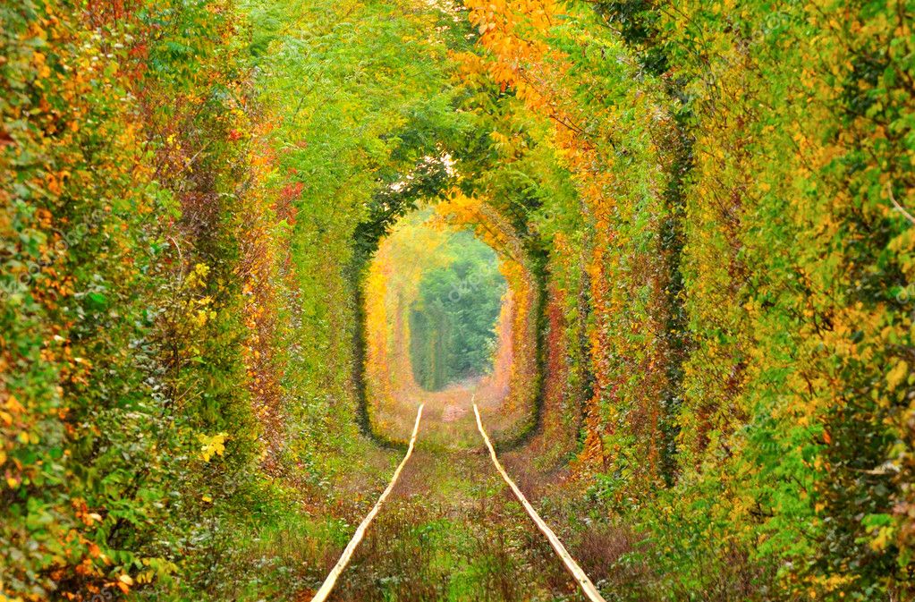
The Tunnel of Love (Ukrainian: Туне́ль Коха́ння, Tunel Kokhannya) is a section of industrial railway located near Klevan, Ukraine, that links it with Orzhiv. It is a railway surrounded by green arches and is three to five kilometers in length. It is known for being a favorite place for couples to take walks.The line starts at Klevan station, on the Kovel-Rivne line, and reaches the northern area of Orzhiv, also served by a station on the main line. The whole line is about 6.4 km long, and about 4.9 km is covered by forest, within which this tunnel stretches anywhere from 3 to said 4.9 km, depending on how individuals count it.
9.MOUNT RORAIMA, SOUTH AMERICA

Mount Roraima lies on the Guiana Shield in the southeastern corner of Venezuela's 30,000-square-kilometre (12,000-square-mile) Canaima National Park forming the highest peak of Guyana's Highland Range. The tabletop mountains of the park are considered some of the oldest geological formations on Earth, dating back to some two billion years ago in the Precambrian.
The highest point in Guyana and the highest point of the Brazilian state of Roraima lie on the plateau, but Venezuela and Brazil have higher mountains elsewhere. The triple border point is at 5°12′08″N 60°44′07″W, but the mountain's highest point is Maverick Rock, 2,810 metres (9,219 ft), at the south end of the plateau and wholly within Venezuela.
8.HITACHI SEASIDE PARK, JAPAN
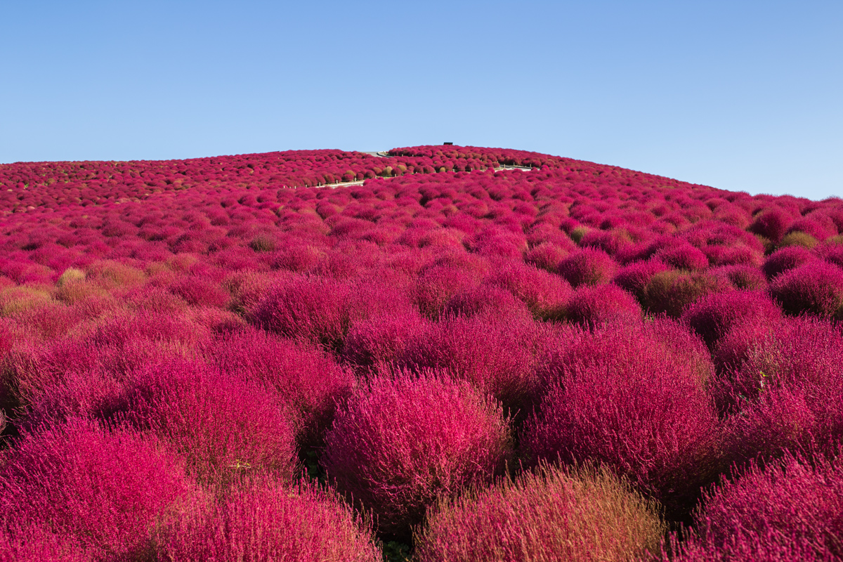
Hitachi Seaside Park (国営ひたち海浜公園 Kokuei Hitachi Kaihinkōen) is a public park in Hitachinaka, Ibaraki, Japan.Covering an area of 190 hectares, the park features blooming flowers around the year. The park has become known for its baby blue-eyes flowers, with the blooming of 4.5 million of the translucent-petaled blue flowers in the spring drawing tourists. In addition to the annual "Nemophila Harmony", the park features a million daffodils, 170 varieties of tulips, and many other flowers. The park includes cycling trails and a small amusement park with a Ferris wheel.
7.TIANZI MOUNTAINS, CHINA
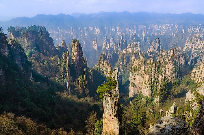
Tianzi Mountain (天子山) is located in Zhangjiajie in the Hunan Province of China, close to the Suoxi Valley. It is named after the farmer Xiang Dakun of the Tujia ethnic group, who led a successful local farmers' revolt and called himself "tianzi". This means son of Heaven and is the traditional epithet of the Chinese emperor.
6.ALGARVE CAVE, PORTUGAL
5.MORAINE LAKE, CANADA

The lake, being glacially fed, does not reach its crest until mid to late June. When it is full, it reflects a distinctive shade of blue. The colour is due to the refraction of light off the rock flour deposited in the lake on a continual basis.
4.MENDENHALL ICE CAVES, ALASKA

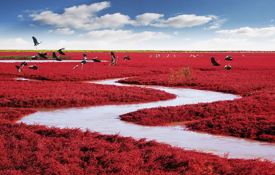
3.RED BEACH, CHINA
2.NAICA MINE, MEXICO

The Naica Mine of the Mexican state of Chihuahua, is a working mine that contains extremely large selenite crystals. Located in Naica in the municipality of Saucillo, the Naica Mine is a lead, zinc and silver mine operated by Industrias Peñoles, Mexico's largest lead producer. Cavernsdiscovered during mining operations contain crystals of selenite (gypsum) as large as 1.2 m (4 ft) in diameter and 15 m (50 ft) long. Peñoles announced in October 2015 that it was indefinitely suspending operations at Naica Mine.
Currently, the high temperature is 58° C (136° F) with 99% humidity, which interferes with breathing and increases the risk of asphyxiation. Because of this, researchers require specialized suits with an oxygen supply to survive working in the environment.
1,ZHANGYE DANXIA LANDFROM, CHINA

The Zhangye National Geopark (Chinese: 张掖国家地质公园) is located in Sunan and Linze counties within the prefecture-level city of Zhangye, in Gansu, China. It covers an area of 322 square kilometres (124 sq mi). The site became a quasi-national geopark on April 23, 2012 (provisional name: Zhangye Danxia Geopark). It was formally designated as "Zhangye National Geopark" by the Ministry of Land and Resources on June 16, 2016 after it has passed the on-site acceptance test. Known for its colorful rock formations, it has been voted by Chinese media outlets as one of the most beautiful landforms in China.
Zhangye Danxia is known for the unusual colours of the rocks, which are smooth, sharp and several hundred meters tall. They are the result of deposits of sandstone and other minerals that occurred over 24 million years. The result, similar to a layer cake, is connected to the action of the same tectonic plates responsible for creating parts of the Himalayan mountains. Wind, rain, and time then sculpted extraordinary shapes, including towers, pillars, and ravines, with varying colours, patterns, and sizes.
Comments
Post a Comment